Posts

Showing posts from July, 2004

VFR flight with Matt

Image
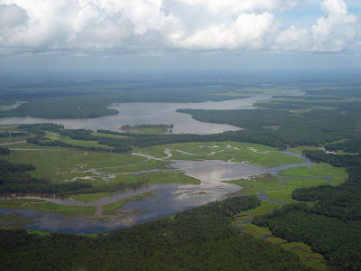
Matt was in town today and he and I went up for 0.9 hours of VFR time this morning. I was worried that the winds would be a bit much, and that the ceiling would be too poor, but the weather turned out to be just fine. We had a low ceiling, something close to a 2,300 feet base of scattered clouds. We went up to 2,000 and set the autopilot to maintain altitude and follow the heading bug. We flew to my neighborhood and then north up the Chickahominy toward the York river. We were trying to spot the movie set that was supposed off that river but didn't. We flew around for a bit over the middle pennisula, doing one steep turn, and headed back to JGG. Shortly after landing we had a nice storm roll in which we thankfully missed.

IFR flight #15 - first cross country

Image
Today I did my first cross-country IFR flight. Charles and I went from JGG to ROA to AVC to JGG over 4.8 hours of flight time. Needless to say, I was worn out at the end of that trip. Last night I used the AOPA flight planner to determine my routes for the trip and to print out nav logs, and flight plan templates for later use when filing flight plans. This morning I filed via DUATS for the leg to ROA - I used the flight planner to do that and really liked that feature. We left around 1pm with (generally) good weather forecast for the entire trip - light winds, a few clouds at 5000 feet AGL. After the pre-flight and a final check of the radar internet pictures we taxied out to 13 to do the run-up and instrument checks. I called up Norfolk on the GCO frequency and received the clearance. I had some trouble understanding the clearance due to the controller's accent, but eventually got it all copied down (and repeated) correctly. She cleared us to 4000 feet and direct to Wakefie

IFR flight #14 - second time in the system

Charles and I got in 1.9 hours today shooting a couple of approaches at the Dinwiddie Co. airport in Petersburg, VA. We first shot the VOR-23 approach and then did an early "missed" to avoid some VFR traffic. From there we asked the controller for vectors to the LOC-5 approach, but it appeared he took us in the wrong direction (NE) for a bit. Charles mentioned to the controller that it appeared we were going in the wrong direction and at the point we starting getting some good vectors. We shot the localizer 5 and did a circle to land for 23, left hand traffic. I was surprised at how natural the LOC approach felt, since I had never actually done one. I have done all the parts of it before, but never together. I all fit together just fine in my head. I was amazed at how busy KPTB was considering it was 10AM on a Friday. There was a decent bit of traffic for a field with no tower. Since we ran out of time we did not get to shoot the VOR-A into W96 . We just headed

IFR flight #13 - first time in the system

Today Charles and I went up for 1.4 hours and it was the first time I have flown in the IFR system. Before I went to the airport I used 1-800-WX-BRIEF to get the weather and double-check that my DUATS flight plan filing worked. It took more than 30 minutes on the phone to get a real person on the line. I believe that is typical nowadays, with so few FSSs, at least when it is a slightly busy time of day. We used the GCO from JGG to call up Norfolk and get our clearance. It was up to me to do the majority of the radio work, and I did about 60% of it. Charles helped me out from time to time as we transitioned b/t approaches. We shot the ILS at Newport News, then on to West Point to shoot the GPS. They had jumpers at West Point when we were coming in, so we went missed at about 2 miles out to play it safe. From there we headed back to JGG on the VOR-B approach. At about 6 miles out we canceled IFR with Norfolk approach and continued on. The JGG radio traffic was getting heavy so we

IFR flight #12

Image
Today we went out for 1.5 hours to do a few GPS approaches, the last approach type that I haven't yet seen (NDB doesn't count since we don't have an ADF). We went to Hummel field to shoot a low approach followed by the holding pattern in the published missed approach. Then we went over to West Point to shoot the VOR/GPS approach. I did a poor circle to land to try to get over to runway 27. So poor that we did a go-around b/c I was close in at about 25 degrees off the center line. We just went direct back to JGG as by then we were running short on time. All-in-all it was not a bad flight for not having been in an airplane for 2.5 weeks. Of course, the GPS and still air were very helpful in letting me maintain tracks and altitudes.